25 Really Amazing Facts About The Himalayan Mountains
There are a lot of amazing facts about the Himalayan mountains. The Himalayas, or ‘dwelling, habitation’, are a mountain range in Asia that separates the Indian subcontinent’s plains from the Tibetan Plateau. This article is full of amazing facts about the Himalayan mountains.
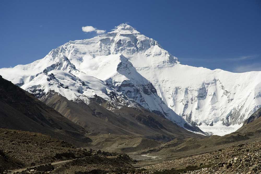
The range contains some of the world’s highest peaks, including Mount Everest, the world’s highest mountain. In the Himalayas, there are over 100 peaks that are higher than 7,200 meters (23,600 feet). The tallest mountain outside of Asia (Aconcagua in the Andes) stands at 6,961 meters (22,838 feet).
Five nations are bordered or crossed by the Himalayas: Bhutan, India, Nepal, China, and Pakistan. India, Pakistan, and China all claim ownership over the range in the Kashmir area. Keep going for learning about many more amazing facts about the Himalayan mountains.
The Karakoram and Hindu Kush mountains border the Himalayan range on the northwest, the Tibetan Plateau on the north, and the Indo-Gangetic Plain on the south.
The Indus, Ganges, and Tsangpo-Brahmaputra, three of the world’s largest rivers, rise near the Himalayas, and their combined drainage basin is home to 600 million people; 53 million people reside in the Himalayas. Hope you are enjoying these amazing facts about the Himalayan mountains!
Amazing facts about the Himalayan mountains
Let’s browse below for 25 amazing facts about the Himalayan mountains.
1. According to scientific evidence, the Himalayas were created by the breakup of the Indo-Australian tectonic plate. The marine limestone near the foot of Mount Everest, for example, revealed that the Himalayas were submerged 50 million years ago.
2. Apart from Hinduism, the Himalayas have an important role in Buddhism, Islam, and Christianity. In all of these religions, it is regarded as divine.
3. India, Pakistan, Nepal, Tibet, and Bhutan are all part of the Himalayan mountain range.
4. The Himalayan mountain range spans west-northwest to east-southeast in an arc 2,400 km (1,500 mi) long, lifted by the subduction of the Indian tectonic plate beneath the Eurasian Plate.
5. The Himalayas are a natural barrier that divides the Indian subcontinent from Tibet. India encompasses the majority of the Himalayan areas.
6. The Himalayas are known in Nepal as Samagramatha, which means “forehead of the sky.” The Himalayas are well-deserving of their moniker.
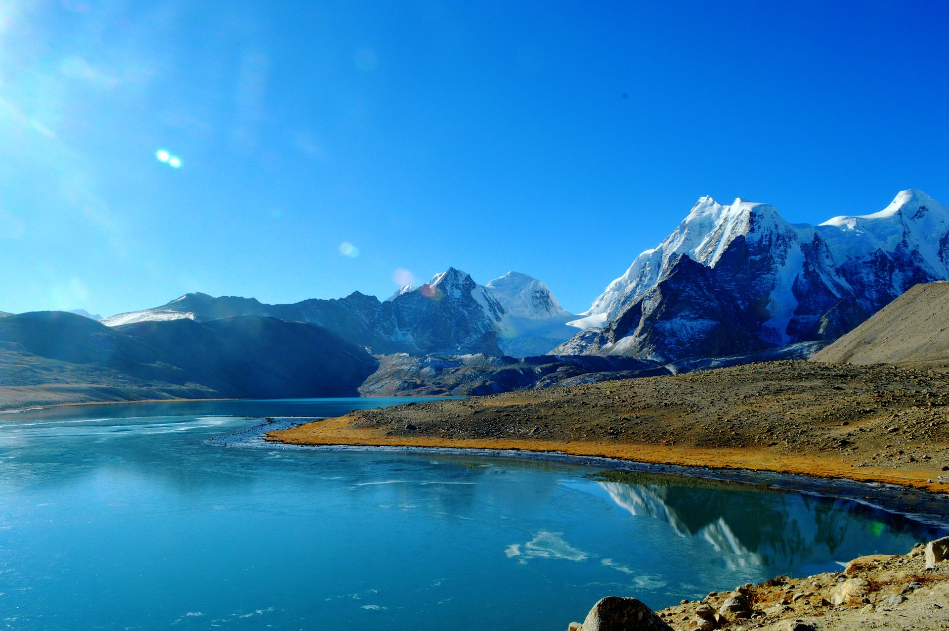
7. The Himalayas have the world’s third-biggest ice deposits, behind the Arctic and Antarctica.
8. Both environmentally and orographically, the canyon divides the Himalayas between Western and Eastern parts — the Kora La pass at the head of the Kali Gandaki is the lowest point on the ridgeline between Everest and K2 (the highest peak of the Karakoram range in Pakistan).
9. The Mahalangur Himal, to the east, has four of the world’s six tallest peaks, including the highest: Cho Oyu, Everest, Lhotse, and Makalu.
10. On the south-western approaches to Everest, the Khumbu area is famous for trekking.
11. Yeti is frequently mentioned in stories about missing individuals and deaths on Himalayan routes. He is said to be a crazy snowman who causes a lot of havoc and even murders people, according to mythology. Yeti, on the other hand, has almost vanished into obscurity, with no scientific proof to back him up.
12. Sir Edmund Hillary and Tenzing Norgay became the first individuals to ascend to the peak of Everest in 1953, making them the first humans to do it.
13. The Himalayas are the world’s youngest mountain ranges, dating back roughly 70 million years. The Barberton Greenstone Belt in South Africa, according to most experts, is the world’s oldest mountain range, dating back 3.2-3.6 billion years.
14. According to scientific research, the Himalayas are shifting towards Tibetian regions due to tectonic plates.
15. Though the Himalayan mountains are mostly in India, they also extend into Nepal, Bhutan, Pakistan, Tibet Autonomous Region, and the People’s Republic of China.
16. Nanga Parbat, its western anchor, is located just south of the Indus River’s northernmost curve. Namcha Barwa, its eastern anchor, is located just west of the Yarlung Tsangpo River’s enormous bend. The breadth of the range varies from 350 km (220 mi) west to 150 km (93 mi) east.
17. In the Himalaya Ranges, fourteen peaks rise beyond 8000 meters. These are the following:
- Mount Everest (8848 meters)
- Godwin Austen (8611 meters)
- Kanchenjunga (8586 meters)
- Lhotse (8516 meters)
- Makalu (8463 meters)
- Cho Oyu (8201 meters)
- Dhaulagiri (8167 meters)
- Manaslu (8163 meters)
- Nanga Parbat (8125 meters)
- Annapurna (8091 meters)
- Gasherbrum I (8068 meters)
- Broad Peak (8047 meters)
- Gasherbrum II (8035 meters)
- Shisha Pangma (8013 meters).
18. Mount Everest was named after Colonel Sir George Everest by surveyor Sir Andrew Waugh in 1865 in honor of his predecessor, but it already had a Tibetan and Sherpa name, “Chomolungma.” The phrase “Mother Goddess of the Earth” translates to “Mother Goddess of the Earth.”
19. Mount Everest, the highest peak in the Himalayas in the globe, is covered with snow that never melts. In reality, the glaciers surrounding Mount Everest serve as freshwater reserves.
20. The Himalayas support 1.65 billion people (20 percent of the world’s population) by feeding major perennial river systems like the Indus and Mekong, which have over 15,000 glaciers containing around 600 billion tonnes of ice.
21. The Himalayas are divided into four mountain ranges: the Sivalik Hills in the south, the Lower Himalayan Range in the middle, the Great Himalayas in the north, and the Tibetan Himalayas in the south. The Karakoram is widely regarded as a distinct mountain range from the Himalayas.
22. The 8,000 m (5.0 mi) peaks of Manaslu and Shishapangma, both in Tibet, lie to the east of Annapurna.
23. Kathmandu, Nepal’s capital and largest city in the Himalayas, is located to the south of these.
24. The Indus Basin is formed by the confluence of western rivers. The Himalayas’ northern and western borders are formed by the Indus. It originates at the junction of the Sengge and Gar rivers in Tibet and travels north-west across India and Pakistan before turning south-west to reach the Arabian Sea. It is nourished by many main tributaries that drain the southern Himalayan foothills, including the Jhelum, Chenab, Ravi, Beas, and Sutlej rivers, which make up Punjab’s five rivers.
25. The Ganges-Brahmaputra Basin is drained by the other Himalayan rivers. The Ganges, Brahmaputra, and Yamuna, as well as numerous tributaries, are its principal rivers. The Yarlung Tsangpo River in western Tibet is the source of the Brahmaputra, which flows east through Tibet and west across Assam’s lowlands. In Bangladesh, the Ganges and the Brahmaputra meet and flow into the Bay of Bengal through the Sunderbans, the world’s biggest river delta.
We know you have enjoyed these amazing facts about the Himalayan mountains!
More Interesting Articles
- 30 Most Beautiful Islands in the World
- How to Plan the Best Indonesia 2 week Itinerary
- A Complete Guide to Gili Island Tour
- 51 Lombok Island Interesting Things To Do
- 20 Secret Islands in the World that Evoke Curiosity
- 30 Popular Hotels near Niagara Falls USA Side
- 15 Niagara Falls American Side Things to Do
- Niagara falls American-side Tour with Maid of the Mist Boat Ride
- Secrets of Niagara Falls American Side vs Canadian
- Discovery Pass Niagara Falls NY – How to Collect
- 12 Niagara Falls American Side Attractions
- Getting to Lake Tahoe – A Transportation Guide
- What Makes a Memorable Tahoe Day Trip?
- Lake Tahoe weekend Trip – Nearby Places to Visit
- 12 Things to Do in Tahoe in Winter – A Travel Guide
- Tahoe Snow Resorts that Every Traveler Can Check
- Lake Tahoe Travel Guide for Adventurous Tourists
- 5 Things to Do in Yellowstone National Park
- Best Things to Do When you Visit Maui
- 10 Best National Parks in the USA One Must See