40 North American Geography Interesting Geographic Cool Facts
North American geography facts are quite amazing. North America is split into a number of different areas and subregions. Among them are cultural, economic, and geographic zones. Economic zones were formed by trade blocs such as the North American Trade Agreement and the Central American Trade Agreement.
This article will feature many more cool interesting fun North American geography facts. Linguistically and culturally, the continent might be divided into Anglo-America and Latin America. Anglo-America comprises the bulk of Northern America, Belize, and English-speaking Caribbean islands (though sub-national entities, such as Louisiana and Quebec, have large Francophone populations; in Quebec, French is the sole official language).
It bears the name of an Italian explorer. It was an Italian adventurer called Amerigo Vespucci who named North America, not the Spanish. Because he was the first to recognize North America as a separate continent, Amerigo was granted this honor.
The size of one national park is comparable to that of Switzerland. Canada not only has several lakes, but it also boasts a large national park. Wood Buffalo National Park is Canada’s biggest national park, covering an area almost the same size as Switzerland. It’s one of Canada’s more than 40 national parks, keep going with more an more North American geography facts.
In the south, the continent of North America is separated into two halves. The two regions in concern are Central America and the Caribbean. Other designated sites can be found in the continent’s north. In contrast to the traditional sense, which encompasses the whole continent, the term “North America” is frequently used to refer only to Mexico, Canada, the United States, and Greenland.
Northern America include the United States, Bermuda, St. Pierre and Miquelon, Canada, and Greenland, all of which are located in the extreme north of the continent. Mexico, Central America, and the Caribbean make up Middle America, which is not to be confused with the Midwest of the United States.
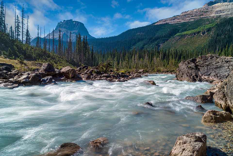
The Great Plains, which stretch from the Gulf of Mexico to the Canadian Arctic; the geologically young, mountainous west, which includes the Rocky Mountains, the Great Basin, California, and Alaska; the raised but relatively flat plateau of the Canadian Shield in the northeast; and the varied eastern region, which includes the Appalachian Mountains, the coastal plain along the Atlantic seaboard, and the Appalachian Mountains. This is one of the cool North American geography facts!
North American geography facts
Lets read out these North American geography facts!
1. Lake Superior is North America’s biggest freshwater lake. With a total area of 82,100 square miles, it is the biggest lake in North America and “superior” to all others. Lake Superior is one of the Great Lakes, a group of five notable lakes in North America. Lake Huron, Lake Michigan, Lake Ontario, and Lake Erie are among the others.
2. The two largest countries in North America by land area, Canada and the United States, have well-defined and recognized regions. Atlantic Canada, Central Canada, the Canadian Prairies, the British Columbia Coast, and Northern Canada are among them (from east to west). Within these territories, there are various subregions.
3. North America is home to all of the world’s main biomes. All of North America is covered by the five primary biomes of aquatic, grassland, woodland, desert, and tundra.
4. Greenland covers a size of 836,300 square miles, making it larger than Alaska, the largest state in the United States. Another interesting fact is that, despite its name, Greenland, the world’s biggest island, is completely covered in ice.
5. There are no landlocked countries or countries that do not have access to the ocean in North America. Every country in the continent is bordered by an ocean.
6. The Rocky Mountains and Pacific Mountains and Valleys physiographic provinces run north-south over the western half of the continent, with the Intermontane Basins and Plateaus in between.
7. The ancient Appalachian Highlands, a mountain range far less rugged than the Rockies but no less influential on the history and development of the United States, define the eastern section of North America.
Plains—the Interior Lowlands and the Great Plains—define the interior of the continent, this is one of the amazing North American geography facts..
8. The Canadian Shield, the oldest section of North America geologically, is to the north, a sparsely inhabited area with poor soils.
9. The Gulf-Atlantic Coastal Plain, which stretches from New York to Texas on the continent’s southern and eastern edges, is a generally flat zone.
10. According to US Census Bureau classifications, these areas in the United States are: New England, Mid-Atlantic, South Atlantic States, East North Central States, West North Central States, East South Central States, West South Central States, Mountain States, and Pacific States.
11. The Great Lakes Region is a shared border between the two nations. Megacities have emerged between the two nations in the Pacific Northwest and the Great Lakes Megaregion.
12. Canada, at 3.855 million square miles, is the biggest country in North America, although only by a little margin. Canada is also the world’s second-largest country, after only Russia in size. Third place goes to the United States.
13. North America has five primary areas that may be divided down into. The Great Plains, Canadian Shield, Eastern area, mountainous west, and Caribbean are among the regions found in North America, according to National Geographic. Various climates exist, ranging from tropical to frigid.
14. Mexico Metropolis is the biggest city in North America, covering 573 square miles and home to approximately 22 million people. New York City and Los Angeles are following closely behind Mexico City.

15. Alaska holds the title of having the tallest peak in North America. Denali, once known as Mt. McKinley, rises to a height of more than 20,000 feet above sea level.
16. Death Valley in California is the lowest location in North America, at 282 feet below sea level. Early lost pioneers gave Death Valley its terrible moniker. They imagined this ominous desert would be their ultimate resting place while all but one of them lived.
17. The Missouri River is the longest river in North America, measuring 2,341 miles. Big Muddy flows from Montana to Missouri, finally merging with the Mississippi River, the continent’s second-longest river.
18. The frigid type E climate of northern Canada and Alaska’s tundra, the tropical type A climate of southern Florida and Hawaii, the type C climates of the humid eastern United States, the seasonal type D climates of the northern United States and most of Canada, and the arid type B climates of the Southwest and Great Plains are among the climates of the United States and Canada.
19. In general, North America is characterized by two distinct climatic trends. The first trend is that as you move from north to south and come closer to the equator, temperatures rise up. The second trend is that precipitation decreases as you go west to east across the continent until you reach the Pacific Coast, when rainfall is copious once more.
20. The northern part of the landmass known as the New World, the Western Hemisphere, the Americas, or simply America is occupied by North America (which, in many countries is considered as a single continent with North America a subcontinent).
21. Following Asia and Africa, North America is the third-largest continent by area, which is one of the interesting North American geography facts.
22. The Isthmus of Darian/Isthmus of Panama is North America’s only land link to South America.
23. Most geographers define the continent in the southeast at the Darién watershed at the Colombia-Panama border, which includes practically all of Panama.
24. Alternatively, some geologists consider the Isthmus of Tehuantepec in Mexico to be its southern border, with Central America spreading southeastward to South America from there.
25. The Caribbean islands, often known as the West Indies, are part of North America, its really one of the coolest North American geography facts.
26. The coastline of the continental United States is lengthy and uneven. The Gulf of Mexico, followed by Hudson Bay, is the greatest body of water indenting the continent. The Gulf of Saint Lawrence and the Gulf of California are two others.
27. The region had been submerged prior to the formation of the Central American isthmus. The West Indian islands mark the location of a submerged historic land bridge that connected North and South America via what is now Florida and Venezuela.
28. The Arctic Archipelago, the Bahamas, Turks & Caicos, the Greater and Lesser Antilles, the Aleutian Islands (some of which are in the Eastern Hemisphere proper), the Alexander Archipelago, the many thousand islands of the British Columbia Coast, and Newfoundland are just a few of the islands off the continent’s coasts. Greenland, the world’s biggest self-governing Danish island, is located on the same tectonic plate (the North American Plate) therefore physically belongs to North America.
29. Bermuda is an oceanic island that originated about 100 million years ago on a rift of the Mid-Atlantic Ridge. It is not part of the Americas geologically. Cape Hatteras, North Carolina, is the closest landmass to it.
30. Because the Cascade ranges in Washington and Oregon prevent rainfall from falling on the leeward side of the mountains, eastern Washington and Oregon are semiarid.
31. There is a substantial rain shadow effect in the western United States. Water vapor condenses as the air rises to pass over the mountains and is discharged as rain and snow. This implies that there is substantially more precipitation west of these mountain ranges than east of them, resulting in dry and semiarid plains.
32. The rain shadow effect affects the whole Great Plains region of western United States, resulting in a semiarid type B climate.
33. The rain shadow effect of the western mountain ranges creates the second climatic pattern. Wet air masses from the Pacific Ocean pass over the Cascades and Sierra Nevada on their way across the North American continent.
34. The North American Plate encompasses the great portion of North America. On the eastern side of the Pacific Plate are parts of western Mexico, including Baja California, and California, including the towns of San Diego, Los Angeles, and Santa Cruz, where the two plates meet at the San Andreas fault.
35. The Caribbean Plate covers the southernmost part of the continent and much of the West Indies, while the Juan de Fuca and Cocos plates form the western boundary of the North American Plate.
36. The main range of the Rockies and the coast ranges in California, Oregon, Washington, and British Columbia are separated in the center, with the Great Basin—a lower region with lesser ranges and low-lying deserts—in between. Denali, Alaska’s tallest mountain, is the highest point on the planet.
37. The geographic center of North America is located “6 miles [10 km] west of Balta, Pierce County, North Dakota” at roughly 48°10′N 100°10′W / 48.167°N 100.167°W, about 24 kilometers (15 miles) from Rugby, North Dakota, according to the United States Geographical Survey (USGS).
38. “No government agency has identified any recognized or monumented location as the geographic center of either the 50 States, the conterminous United States, or the North American continent,” according to the USGS. Despite this, Rugby has a 4.6-meter (15-foot) field stone obelisk that claims to represent the center.
39. The North American continental pole of inaccessibility is located between Allen and Kyle, South Dakota, at 43°22′N 101°58′W / 43.36°N 101.97°W, 1,650 kilometers (1,030 miles) from the nearest shore.
40. Mexico is mostly in the western part of the country, with its extensive plateaus and cordilleras, however the eastern coastal plain does reach south along the Gulf.
Hopefully, you have found these North American geography facts, quite interesting, cool and full of learning and fun.
More Interesting Articles
- 22 Best Waterfalls Near Me to See in Lifetime
- 15 Best Waterfalls in Yosemite People Love to See
- Best Time to Go to Havasu Falls with Right Plan
- Katavi National Park – Travel Season | Plan | Guide
- Attractions of Visiting Iguazu Falls – A Travel Guide
- Iguazu Falls Tours Both Sides – A Travel Guide
- 20 Breathtaking Waterfalls in the World
- 12 Great Smoky Mountains Waterfalls to Explore
- 26 Scenic Waterfalls Near Me – Come to Nature
- What is the Best Time to Visit Iguazu Falls?
- 30 Most Beautiful & Prettiest Tropical Places in World
- 7 Cozy Castle Hotels in Ireland People Love to Stay
- 75 Things People Love to Do in Bali Trip
- 10 Best Reviewed Norway National Parks
- 19 Mind-blowing Natural Norway Waterfalls
- Seven Sisters Waterfall Norway – Travelers’ Guide
- 22 Prettiest Islands in the World You Must Visit
- 10 Affordable Hotels in Tanzania for Luxury
- 65 Best Hotels in Dublin Ireland for a Cozy Stay
- 52 Affordable Castle Hotels in Europe – Be a King (or Queen)