28 Very Interesting Mount Mitchell Facts People Enjoy To Know
Mount Mitchell facts are quite interesting. Mount Mitchell, also known as Attakulla in Cherokee, is the highest mountain in the Appalachian Mountains and mainland eastern North America. It’s in Yancey County, North Carolina, near Burnsville, in the Black Mountain subrange of the Appalachians, about 19 miles (31 kilometers) northeast of Asheville. Mount Mitchell State Park protects it, and the Pisgah National Forest surrounds it. The summit of Mount Mitchell is 6,684 feet (2,037 meters) above sea level. In this article, we are going to feature many more Mount Mitchell facts like these.
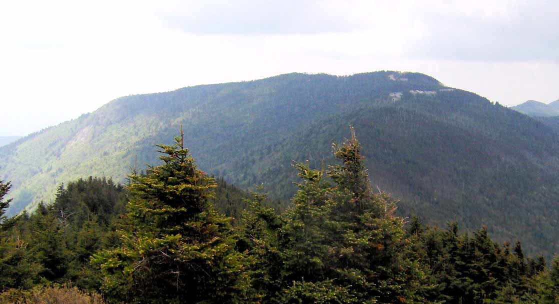
Mount Mitchell facts
Here are 28 very interesting Mount Mitchell facts!
1. Location of the Mount Mitchell is in Yancey County, North Carolina, United States
2. Parent range of Mount Mitchell is the Appalachian Mountains
3. Elevation of Mount Mitchell is 6,684 ft (2,037 m)
4. Prominence of Mount Mitchell is 6,089 ft (1,856 m)
5. Isolation of Mount Mitchell is 1,189 miles (1,914 km)
6. August is the hottest month with its record of 81°F (27°C)
7. January is the coldest month with its record of −34°F (−37°C)
8. Mount Mitchell, also known as Attakulla in Cherokee, is the highest mountain in the Appalachian Mountains and mainland eastern North America.
9. Mount Mitchell is in Yancey County, North Carolina, near Burnsville, in the Black Mountain subrange of the Appalachians, about 19 miles (31 kilometers) northeast of Asheville.
10. The summit is the tallest mountain east of the Mississippi River in the United States and the highest in eastern North America south of the Arctic Cordillera.
11. The nearest higher peaks are in South Dakota’s Black Hills and Colorado’s Highland foothills.
12. The topographic isolation of the mountain is measured from the next observable single higher peak, Lone Butte in southern Colorado, which is 1,189 miles (1,913 km) distant.
13. Mount Mitchell is bordered by the Pisgah National Forest and is protected by Mount Mitchell State Park. The summit of Mount Mitchell is 6,684 feet (2,037 meters) above sea level.
14. The Cherokee people named the mountain Attakulla because it was part of their territory for a long time.
15. Because of its spherical form, European-American settlers named the peak Black Dome.
16. The picturesque Blue Ridge Parkway is connected to a parking lot where a steep paved 980-foot (300 m) route goes through a conifer forest to the top by a 4.6-mile (7.4-kilometer) road (NC 128).
17. The summit’s 40-foot (12-meter) stone observation tower was demolished in late 2006.
18. In January 2009, a new observation deck was built and opened to the public. Elisha Mitchell’s grave is also located on the top.
During the Precambrian period, marine sediments metamorphosed into gneiss and schist, forming Mount Mitchell. During the Alleghenian orogeny, these metasedimentary rocks were elevated.
19. The soils surrounding the top are well-drained, dark brown, and rocky, with fine-earth material varying in texture from sandy clay loam to loam or sandy loam; the Burton and Craggey series being the most frequent.
20. The summit of the mountain is covered with a dense stand of Southern Appalachian spruce-fir forest, which is mostly made up of two evergreen species: red spruce and Fraser fir.

21. Plantlife is exposed to high amounts of pollution at high elevations, including acid precipitation in the form of rain, snow, and fog. These acids harm red spruce trees by releasing natural metals such as aluminum from the soil and leaching essential minerals.
22. Mount Mitchell’s summit is characterized by a warm-summer humid continental climate (Köppen Dfb), with pleasant summers and lengthy, fairly cold winters, more akin to southern Canada than the southeastern United States.
23. The monthly average temperature varies from 25.2 degrees Fahrenheit (3.8 degrees Celsius) in January to 59.1 degrees Fahrenheit (15.1 degrees Celsius) in July.
24. The state’s lowest temperature was 34 degrees Fahrenheit (36.7 degrees Celsius) on January 21, 1985, during a severe cold wave that pushed freezing temperatures as far south as Miami. It is also the state’s coldest average reporting station, with a temperature of 42.9 degrees Fahrenheit (6.1 degrees Celsius), considerably below any other station.
25. Unlike the lower altitudes in the surrounding regions, significant snowfall is common from December to March, with the Great Blizzard of 1993 collecting 50 inches (1.27 m) and the January 2016 blizzard producing 33 inches (0.84 m).
26. Precipitation is substantial and consistent year-round due to the high elevation, averaging 74.7 inches (1,900 mm) each year, with no month getting less than 5 in (127 mm) of average precipitation.
27. The peak is frequently windy, with gusts of up to 178 mph (286 km/h) recorded.
28. In 2018, Mount Mitchell received 139.94 inches (3,554.5 mm) of precipitation, a state record, and the greatest calendar year total rainfall recorded anywhere east of the Cascades in the continental US.
We hope these interesting Mount Mitchell facts were worthy to you!
More Interesting Articles
- 25 Awesome Lake Tahoe Things to Do in Weekend
- 7 Awesome Places for Thrilling Lake Tahoe Skiing
- Top 10 Stunning Lake Tahoe Beaches to Visit
- To Do in Glen Canyon National Recreation Area
- Glen Canyon National Park Travel Guide
- 17 Travel Attractions of the Lake Tahoe City
- 32 Cozy Lake Tahoe Hotels, Resorts, and Lodges
- Top 10 Natural Wonders of the US to See in Life
- 11 To-Do while Traveling Lake Tahoe in Summer
- Monument Valley Tours – How to Plan
- 40 Monument Valley Facts Everyone Should Know
- 6 Places for Thrilling Monument Valley Camping
- List of Monument Valley Hotel You can Check
- 13 Memorable Things to Do in Monument Valley
- Grand Canyon National Park Travel Guide
- Monument Valley Transportation Guide
- Monument Valley Visitor Center
- Southeastern Utah Sights – Must-See Sights in Utah
- Monument Valley Scenic Drive – A Complete Guide
- 10 Beautiful Utah National and State Parks